Saturday, August 18, 2012

I'm Back in the Saddle Again!

Well, metaphorically, anyway. After a hiatus for what turned out to be more than just a simple bacterial conjunctivitis (see this entry), a hiatus that included CONTACT ISOLATION for Pete's sake, we got back out on the trail today. And it felt sooooo good! We had beautiful weather, too.


We debated Wenonah Trails, Parvin State Park, and others. After discovering Parvin is closed because of damage from the recent storms I asked the future trail runner to look at the info I had on Maurice River Bluffs Preserve in Cumberland County. She agreed with me that this looked interesting, and we told the other two of our choice. My only complaint is that the map is not very detailed, but I hoped maybe there would be an updated one at the trail head. There was not, but there was volunteer steward there who knew the trails, including the new yellow they speak of on the link above (which is not the yellow you see in the photo above -- that's the boundaries of the preserve). It was easily accessed off the junction of the red and white trails.


When you enter the preserve, you come almost immediately to the blue trail, and we turned left onto it, headed toward the red trail. If you've read other entries, you know we pinkpuffyheart love well blazed trails, and this fit the bill. Even the little one could find and follow their blazes. At most of the trail junctions we came to there were also directional posts.

So, when they named this "Maurice River Bluffs" I wasn't sure what to think of that, but rest assured, there are enough steep slopes, small gorges, and pretty much the perfect setting for re-enacting The Hunger Games for anyone. Unfortunately, most of the photos I tried to take don't realistically convey the depth. I suppose one of these days I should watch the CD that came with my digicam, or maybe take a class. Ooooh, I think REI offers one.....

So we aren't on the red trail long before we're on a ridge:


Even the tree is holding on!


It turns out that lower area is where you end up next, after a switchback:


All kinds of fun stuff in this preserve! It had recently rained, so there was tons of funky fungi (say THAT 3X fast!). Some of the standard toadstool, bracket fungi, etc. but then there were neon yellow ones, coal black ones, and this little stand that reminded me of enoki mushrooms:

Don't tell my Irish ancestors, but it was my husband who pointed out this is a Faerie Ring

There were also some seriously strange, Area 51-looking trees like these:


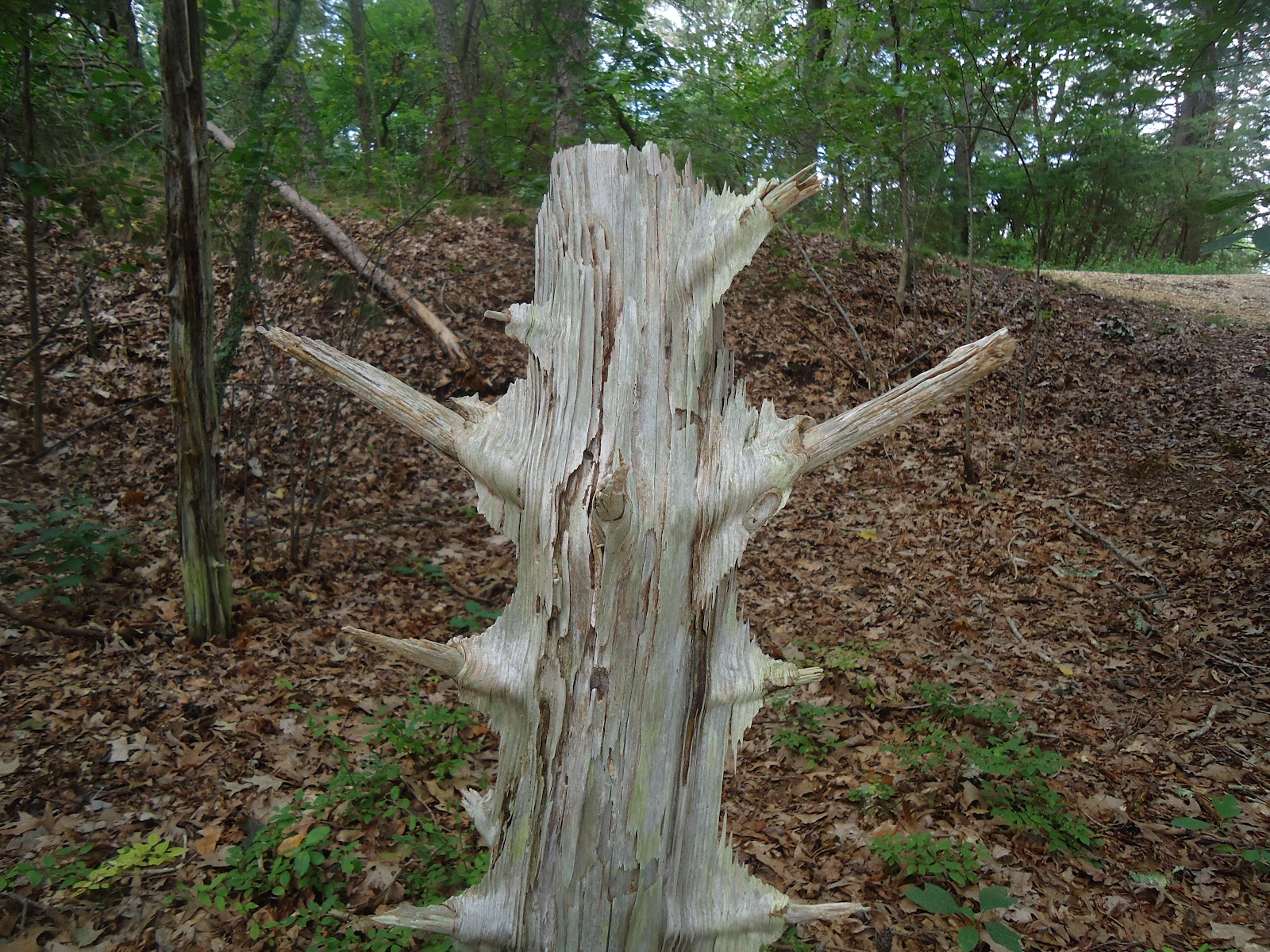
Any arborists out there who can tell me what the deal is with these spiky trees???


There were also a few large trees down from the storms last month, like at Parvin. We were able to get around this monster, but someone on a mountain bike would not have been able to:

If you squint you can see a bit of pink and blue in the center there...
This break was approx. 25ft up
Both the white and yellow trails come up along the river, and when we reached the water the girls wanted to dip their tootsies in. I thought it would make a nice break before heading up the yellow trail, so I let them have a bit of time once we moved up away from the folks with the jet skis.


Once they'd had their fill of squishing sand between their toes and trying to identify every.living.organism they could see, we moved on to the yellow trail. I had read the trail had "a 35-foot long bridge, steps and rails throughout the steeper parts" which sounded pretty darned cool to me, so we headed off. We quickly came upon a steep incline and the girls begged to climb up. I stayed down on the trail so I could observe all three at once.


I was *perfectly* positioned, therefore, to see the middle daughter build up more momentum coming down than she could handle, and whoopsie daisy! tumble down head over heels. She was crying right away, in that high pitched "I'm wounded!" way, but she was also flailing all 4 limbs immediately so I held off sending up a flare. She is bruised and has a nasty scratch on her shoulder blade, but she's okay. Once she was calm I took the opportunity to educate all three of them on how to better handle a slide on a trail, mainly by choosing their immediate path wisely, and to get and stay low. The mishap really made her want to head back, so we will save the yellow trail for another day.

On the hike back in, I turned at one point and saw this, and couldn't resist snapping a picture:


And she also spied this little fellow waiting to say goodbye:


If you're ever in the area, you should really check this area out! Look for this sign on Silver Run Road =)...


Tuesday, July 31, 2012

A Different Smithville

Typically, when our family talks about going to Smithville, we mean Smithville Village in Atlantic County. There are quaint little "shoppes", a small lake, a train you can ride, and a beautiful old fashioned carousel (the girls' favorite). When researching hiking trails in the area, I came across a different Smithville -- Historic Smithville Park in Burlington County. It seemed interesting from the info I'd read, but I'd been fooled before and am still licking my wounds (so to speak) from that! A coworker had said she has ridden her bike on some of the trails there, so I put it in my "maybe" file.

I've been in essentially contact isolation for over a week because of a rare, highly contagious form of conjunctivitis, and I'm going a little squirrelly. Since hiking is something I can still do without risking exposing anyone, it's not prohibited. The Oldest is in Girl Scout day camp this week at Inawendiwin in Tabernacle, and I wanted to do something with the Little Girls since, um, they weren't (next year, Littles!). I thought of Smithville Park, and decided to see if they had trail maps or brochures. We had not planned on hiking, but it worked out otherwise. As it turns out, I parked in the worst parking lot for where we ended up hiking LOL. We found the Mansion, and walked around in the grounds for a good long while, playing maze in the garden, admiring the architecture, and taming the lions:


The mansion has a lovely walkway dedicated to Women's History, right near this arbor:


The girls decided they wanted to hike the Red Trail, mainly because it has a Butterfly Garden. I did not point out to them that technically, it is the longest, because none of these trails are particularly long. If I'd had the map with me and knew we were going to choose that trail, I'd have parked in the Smith Woods lot, or better still the Municipal Lot at the corner of Smithville Rd. and Railroad Ave. It was a bit dicey walking the short bit from the Mansion down to the Red Trail head because there are no sidewalks on Smithville Rd. and the traffic moves swiftly.

The Red Trail starts out more like a bike path, with wide, flat trails:


with lots of curious things to see along the way, like this tree with bark that swirls like a barber's pole:

The path meanders alongside a creek for a while:

with benches at little scenic overlooks every couple hundred yards or so. When it turns south away from the creek the path is anything but linear, but is so well blazed that you have no trouble staying the course. There are some fun little bridges and steps along the way too:


until you come to the junction of the red and orange trails, where the playground, a picnic area, and the Butterfly Garden are:


See the Gazebo in the background?

The Red Trail cuts across the parking lot, through a not so interesting field, and back out to Smithville Road. We crossed over and picked up the Green T which was much more interesting right off the bat, with a slope that leads to the first of several bridges, all of which lead to the Floating Trail across Smithville Lake:


The north end of the Green Trail winds to the western part of the Red Trail, which we took past the canoe launch to Park Avenue, an internal road in the park. We had already seen part of the other end of Park Avenue when we came out behind the mansion and the girls spied a photo op in the gazebo:

That's Park Avenue to the left in this photo
Parking lot B is behind the historic buildings, and where our car was. If we weren't pressed for time to get back for an opthomologist appointment I would have loved to check out some of the old growth trees that are supposedly in the ravine off the Blue Trail. Next time, I suppose! And next time, I'll park in Lot E off River Street!

Saturday, July 21, 2012

Hiking (Slowly) with some Family!

Today we were joined by my sister Squirt and her daughter Princess! Princess is the same age as our middle girlie, so whenever they are together they are thick as thieves. Hopefully one day Little Man will join us, but he begged off for today. Maybe if I plan a hike to Washington's Crossing or some other historic place...

Anyhoo, today we hiked some of the Wenonah Trails again, but this time on the East Side of the railroad. We started on the connector from E. Pine St. and S. Clinton St. (hi Patrick family!!), and again I was glad I had the official Wenonah Trail Guide which we picked up at Town Hall. Without it, I would never have known that the trail head was the "paved lane" at the end of S. Clinton and looks like the neighbor's driveway. Even so, some of the twists and turns on this trail don't exactly match up with the map (I guess that's why they called it a "guide" -- it's more of a vague suggestion LOL). This trail head marks the beginning of the Garden Trail, and quickly you come upon a flagstone path which leads to this:


As you can see, they left without me! Luckily, Squirt was with them...
According to the plaque, the original pond was created in 1913 as part of the Greene estate and recently the area was spruced up, including a stone bench to sit and enjoy the quiet, by the Women's Club. The kids missed the "quiet" part, but one of them spied the deceased frog floating in the pool. "It's not yucky, it's the Circle of Life, girls!" Sorry, no pictures of Mr. Floaty...

We crossed a bridge over the Monongahela Brook to pick up the Monongahela Brook Trail. At this point was one of the "huh?" moments: there was a trail marker, but it did not say Monongahela Brook Trail. It indicated street names, neither of which was on the map. We chose to go right, and quickly figured out it was the dead end at the Mantua Creek. Okay, double back and go in the other direction to get back to the trail. Lots of sloping, tight, winding up and down trails here, lots of fun! Oh, and a short boardwalk over a bog, too =). According to the Guide, this section was used by Native Americans in the area, and I have to admit, if you let your imagination run a little you can easily imagine yourself hunting game with a bow and arrow here, especially while up on the ridge...

Ok, so then we crossed over Bark Bridge Road, and expected to hike to a T intersection at the Eldridge Trail, named after a local naturalist. Nope! Next thing we knew we were coming out to E. Pine Street, and looking for the connector to the Comey's Lake Trail. We ran into a young couple out walking and they were not sure if the dirt road in front of us marked "Private Property" was the connector either, but we decided to go for it. As it turns out, it was. We quickly saw a trail post for the Comey's Lake Trail and set off.

The Little One took the lead for this bit initially, and although Squirt and I figured out we were likely on the path less travelled, we were still heading along the lake so we weren't concerned. Shortly the Tea House came into view, which was where we planned to take a quick granola bar break:

Photo from Matt Reddig at www.localhikes.com

The Princess and her Buddy

The Little One and Aunt Squirt

The Oldest is just like her Da -- never without a book!


After our snack we set off again to complete the loop around the lake. Once we reached the dock, it was hard to figure out if the way around the lake was private property or not. Afterward, I checked the comments on the Guide and it is, but they allow egress. We tiptoed through the last bit of that loop ("pretend you're ninjas!") and out to the connector. At that point we headed back to the cars, since a vote in the Tea House about whether to try to make our way to the Monongahela Brook Loop Trail (not to be confused with the other trail) was in favor of calling it a day.

If you check out the east side if the rails on "informal" map below, our route pretty much worked out to be the red bit, the orange trail, the west side of the blue trail, the teal loop back to a bit of the blue before heading west on the road (below the label "Playground") back to the cars, roughly 2mi:

(Borrowed from Wenonah Environmental Comission site)

I think if we hike this section again I'd like to do red-orange-south part of blue-pink-north part of blue-road.

Have I mentioned yet that you really need the Guide for a lot of the "insider" info??

It was nice to hike with family, especially Squirt. Reminded me of our Girl Scout days long ago...

The Oldest wants to add: "I think that hiking with family is sometimes frustrating like it can be at family dinners but it is also fun and a new experience. I recommend it if you don't mind your relatives, because otherwise it's fun! Especially if you're hiking with my cousin, Princess!"


Friday, July 20, 2012

I'm Not *Technically* Cheating on LLBean...

... but we are seeing other people, LOL! Last night I went to a class at the REI Outdoor School in Marlton on "Hiking with Kids -- Basics". Although there were 10 people signed up, only 3 adults (including me) and 2 kiddos were there. It was a true shame the others missed this class, because there was lots of solid beginner info, a relaxed and easy learning environment, and FREEBIES! Yes, the instructor gave away FREEBIES in a class that was FREE! Each family received a Kids' Adventure Journal (PDF version without the cool stickers available here) for recording their treks and a really cool Coughlan Kids 7-in-1 binocular set, one of each for each child in their family!

The instructor was Mark Hughes, an REI staffer and two-time Appalachian Trail Thru-Hiker <insert image of me bowing here>. That's 2,184 miles people -- each trek! Mark wrote a book about his experiences (including his first attempt in which he decided he needed more info at 50 miles in), which I am planning on ordering on Amazon tonight (no, REI doesn't stock it for some reason):


He was a super nice person, very humble and knowledgeable, and his love for the outdoors and everything you experience there just shone through. I will definitely be attending more classes and events there.

And the funniest part? He is currently living in our town! Cool, huh?

More info on the Appalachian Trail (which I've hiked a wee small part of):
Wiki Entry
AT Conservancy
National Park Service Listing

Someday, maybe after we win Powerball, I'll section hike the whole thing...


Wednesday, July 11, 2012

Live, Learn, and Soldier On!

Soooo, today we set off bright and early for the Evert Trail Preserve in Pemberton. As you can see from the picture on the website (below) this looks like an easy stroll in a verdant preserve:


Well, to quote The Other Guys, "I call b###s### on that!" This trail was extremely overgrown, so much so that I told my mom afterward that I should have brought a machete. I was not suprised to find downed trees after the recent storms, and to be honest, it was kinda fun scrambling over and under them. That's all part of the experience. But the rest of it was kuh-razy! The trail map shows that there are 24 trail markers along the way, and things to see, but there were no brochures at the trail head to tell you what each marker signifies, nor are they available online as far as I could find. You will find most of the markers, but they are just numbers carved into poles, nothing more. And the things on the map, like Wildflower Way and The Hole? We could not find them at all. At the marker for the Hole, the trail just ends. Dead end. Not even a depression in the ground as far as we could see.

All that being said, we did manage to find some fun along the way. We have no idea what the heck this vertical wall of vegetation is/was, but it was cool to find!

What the heck is the Little One doing in this picture??
And the foodie in me was excited to find fiddlehead ferns (not the best picture):


At the end, I told the girls I was proud them for "soldiering on" when this trail was shaping up to be something other than we thought. They were proud of themselves too, but we all agreed we'd never grace this trail again. Well, maybe if we get notified that someone has made this trail his Eagle Scout project or something...but probably not! And I will make every effort to "pre-hike" any more trails sponsored by the NJCF.


One bright note: despite the jungle-like conditions, no one seems to have poison ivy/oak/sumac so far (knock wood)!!

Friday, July 6, 2012

Elephant Swamp Trail

Once again, we found ourselves with The Gift of a Chase Car. The Wonderful Husband took the day off to go visit friends a few hours away, but wasn't leaving until the afternoon. Coincidentally, I had planned to hike in the morning because it is suppose to get up to the high 90's this afternoon. Given the fact that Wonderful was willing to help us, I decided we'd hike the first part of the Elephant Swamp Trail in Elk Twp. We had briefly checked out this first segment before, but only went in about 15min and then doubled back. From the trail head at Aura-Woodstown Rd to the first road crossing at Swedesboro-Franklinville Rd. looked to be about 1mi, based on the scale of the map. The littlest one hasn't been as enthusiastic about mileage as the bigger two, so our tentative plan was to start at the trail head and have Wonderful meet us at the first road crossing. If the littlest was doing fine, we'd continue on, but if she was pooped out or just plain cranky she'd join Wonderful in the chase car. After that we'd continue to the next road crossing at Monroeville Rd where we started out the last time. Once we made this trek we'd have hiked the whole trail (in segments). From the trail head to Monroeville Rd is approx 3mi.

This trail head is not marked, and you have to go alllll the way to the back of the recreation area behind the soccer fields to find it. If you have the last field and Port-A-Potty on your left, the trail head is directly in front of you, looking dark and lush and inviting =). This is definitely a buggy area, so unless you like anti-itch lotion and tick treatments, use bug spray! Most of it is heavily shaded too, which is nice.

Because of the recent storms, there were a few downed trees across the road, although most fell in a way that formed a natural gate, for active imaginations:

photo taken by the Middle One!


The littlest one started out strong in the lead, but quickly tired. When we got to the first crossing she gladly joined Wonderful in the van and the bigger two and I continued on.

This second section is more "developed" in that there is a fancy trail entrance area:

(from Trail Link)

and there are informational signs along the way highlighting flora and fauna. I'm not sure about all kids, but our kids really love that kinda stuff! Today they learned how to identify a sweet gum tree (the one that produces all those sticker balls). About halfway through the second part we came upon a creek, which was a fun little diversion for a while:


I'm not sure what the deal is with our kids and accidentally slipping into creeks, but it happened AGAIN, only with a different kiddo this time. Other than soggy shoes, there was no harm done. At one point you actually cross the line from Gloucester County into Salem County, and there is a stone marker to let you know:
(from Trail Link)


We played a few minutes of "Look! I'm in Gloucester County! Look I hiked all the way into Salem County! Now I hiked back to Gloucester County! Whew! (all the while taking giant steps back and forth at the post...)" Their hiking speed is improving, so even with playing in the creek for a while and this silliness, we still made it back to the Fire Department parking lot on Monroeville Rd by the time we said we would meet Wonderful and the littlest.


As it turns out, the littlest one amused herself while waiting by playing "bongos" on some cut up logs. She was not too disappointed when she was told about the creek, thank goodness. After we left, Wonderful showed us some neat things they found exploring while we were hiking, including Lake Garrison and a farm with our family's name! 

We rounded out the trip with lunch at one of their favorite places, The Country Crock Restaurant in the Stolzfus Amish Market. Millard Hahn was a gracious host as always, my family ordered Corn Fritters (as always LOL), and everyone was satisfied. The Hahns and their employees always make you feel like family friends =), especially Mrs. Hahn and Wanda, who we frequently get as our waitress.

I already have a plan for the next hike!

NB: Two of the above photos I borrowed from an entry at Trail Link , a website powered by the Rails to Trails Conservancy. It's a fantastic resource for finding trails for hiking/biking/running/riding. Check it out!

Wednesday, June 27, 2012

Make New Friends...

Today I chose a hike closer to MomMom, in hopes that she could join us. Alas, she was having work done at her house and couldn't come with us. Saddler's Woods is about 4 miles from her, so we stopped in there before and after.

At the Trail Head

The history of this place is pretty interesting (see info on the link), including a tree that may have been part of the Underground Railroad. We entered the trail on Hope Trail, and at the T intersection made a right to go toward the Wet Meadow area. A few minutes later, Brigid takes the Road Less Travelled:


See that purple triangle shape up the trail to the right? We followed her up that path, which spurred off to a steep hill. It's hard to see the degree of the slope in the picture, but I think it's probably at least 40*:


After a few moments of "I'm King of the Mooouuunntain!" and "I can see MomMom's HOUSE from here!!" we reversed course and went back to that T intersection. A group of 3 women with some young girls and babies were coming into the same area. They asked if we were the Girl Scouts, because they had seen the magnet on our van. As it turns out, the two older girls were Girl Scouts too! Coincidentally, I happened to be wearing my Rock the Mall t-shirt. Their girls had just been to the B.I.G. Celebration. And the mama of the Girl Scouts also has a family hiking blog! So, what do a group of Girl Scouts do when they run into other Girl Scouts they haven't met??

"Make new friends" of course!

We explored the area with them for a good while, happy to have "veterans" along to point out lots of cool things, like this tree growing like a trident:


Two of the ladies with sleepy wee little ones bid us goodbye, and the rest of our new friends stopped to eat lunch for a bit. We were planning on lunching with MomMom, so back into the woods we went, this time from the Doug Hefty trail (note: Read about him on the Saddler's Woods website, neat story!). The stream was calling them, and tried to claim someone's sneakers:


The rest of the time we just meandered around, enjoying the beautiful weather.


Emancipation Beech, a 300 year old tree
(read more about it on the website)

Overall, a nice day out, especially with the surprise of Making New Friends....